eROSITA Mission Planning

eROSITA - All-sky survey
The 4-year eROSITA all-sky survey has started in mid December 2019. In the currently applied survey strategy, the scanned great circles are aligned with the ecliptic coordinate system and are progressing by about one degree per day.
Each of the eight all-sky scans has a duration of 0.5 yr.
Completed: eRASS1 (June 2020), eRASS2 (December 2020), eRASS3 (June 2021), eRASS4 (December 2021); eRASS5 (eROSITA was put into safe mode on 26.02.2022 and is currently not taking data)
eROSITA scans the sky with a rotation period of 4 hours, its FOV has a diameter of 1.03 deg.
Monthly planning
eRASS - scanned ecl. longitudes
| UTC | MJD [d] | ecl. lon. [deg] | ecl. lon. [deg] |
|---|---|---|---|
| 2022-03-01 00:00:00 | 59639.0 | 067.830 | 247.830 |
| 2022-03-02 00:00:00 | 59640.0 | 068.680 | 248.680 |
| 2022-03-03 00:00:00 | 59641.0 | 069.530 | 249.530 |
| 2022-03-04 00:00:00 | 59642.0 | 070.380 | 250.380 |
| 2022-03-05 00:00:00 | 59643.0 | 071.230 | 251.230 |
| 2022-03-06 00:00:00 | 59644.0 | 072.080 | 252.080 |
| 2022-03-07 00:00:00 | 59645.0 | 072.930 | 252.930 |
| ... | ... | ... | ... |
Given longitude columns are scanned 'up' and 'down' resp., i.e. towards ecl. north/south pole, using nominal scan direction.
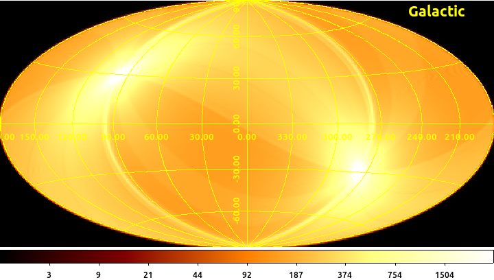
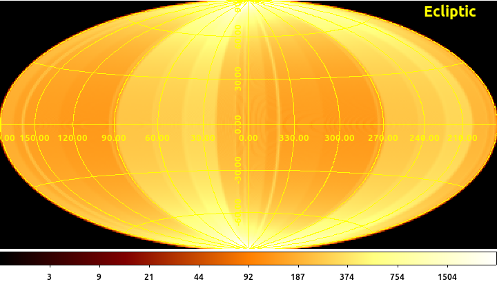
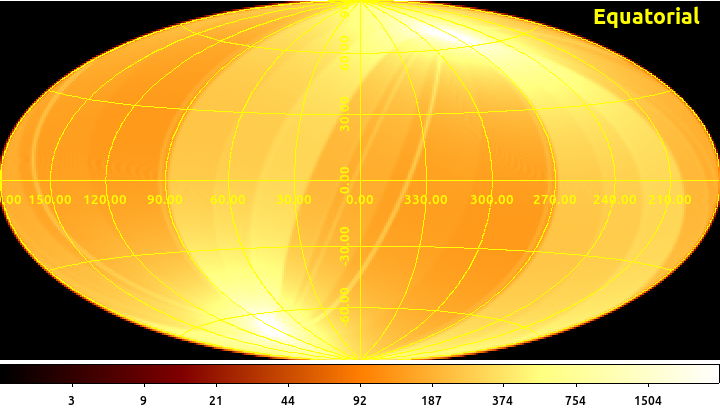
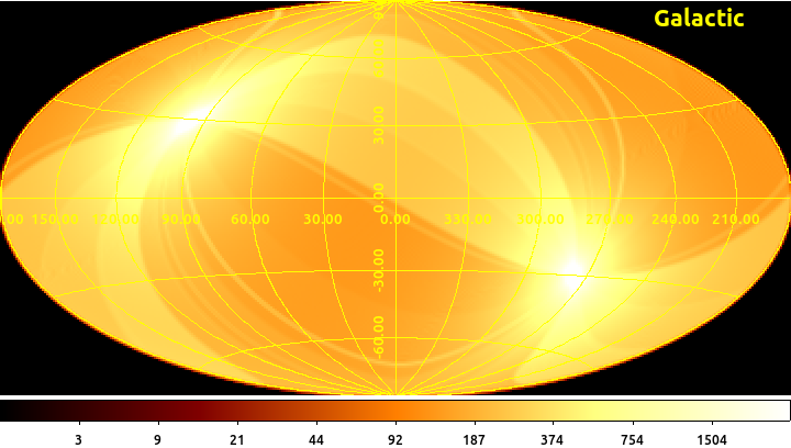
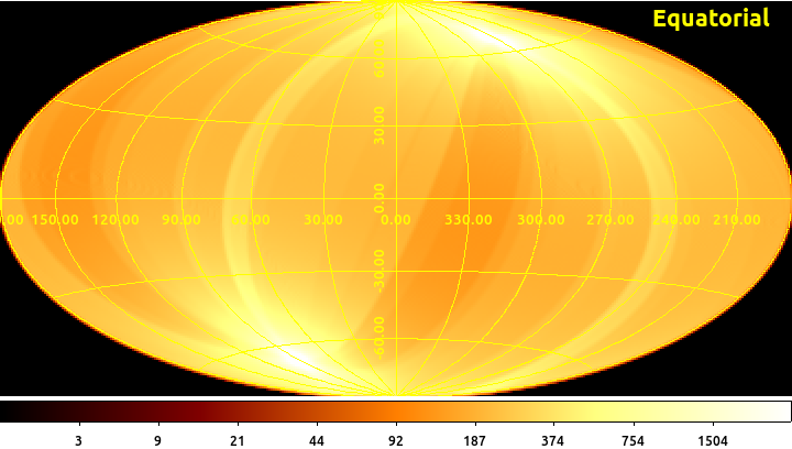
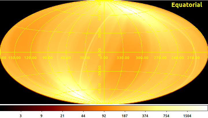
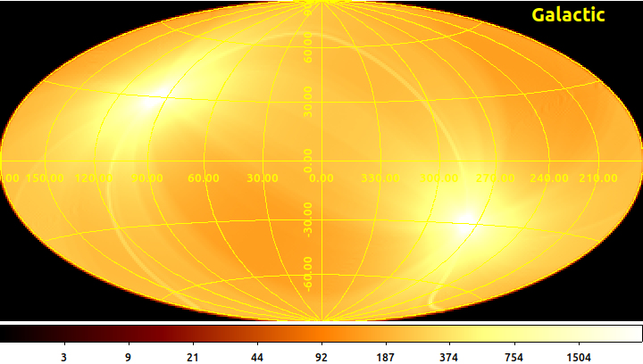
eRASS - scanned sky area/month plan
Scanned sky in equatorial (left) and galactic (right) coordinates.
Planning file
| TSTART | TSTOP | SCP_START | SCP_OMEGA | SCP_ELON | SCP_ELAT | RA_Z0 | DEC_Z0 |
|---|---|---|---|---|---|---|---|
| 2022-02-27 17:30:00 | 2022-03-02 17:30:00 | 336.750 | 0.850 | 0.00 | 90.00 | 338.487 | -9.034 |
| 2022-03-02 17:30:00 | 2022-03-07 17:30:00 | 339.300 | 0.850 | 0.00 | 90.00 | 340.879 | -8.083 |
| 2022-03-07 17:30:00 | ??? | ... | ... | ... | ... | ... | ... |
Survey control parameter: TSTART/TSTOP (UTC), SCP_ELON/SCP_ELAT (survey pole, ecl. coordinates), SCP_START (start angle of scan axis in survey plane), SCP_OMEGA (angular velocity of scan_axis within survey plane), RA_Z0, DEC_Z0 (scan axis/SC_Z position at start, equ. coordinates), units are [deg] and [deg/d].
Current and upcoming survey scanning times can be estimated under 'Viscal'.
Previous survey scanning times can be checked under 'Histcal'.
The growing eRASS
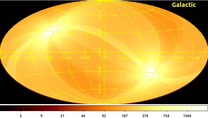
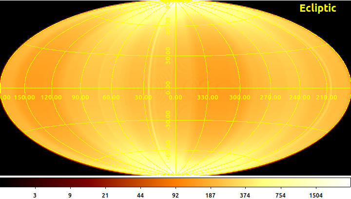
eRASS - scanned sky
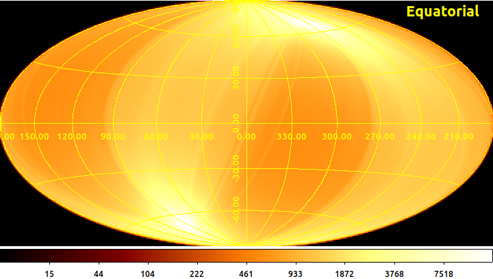
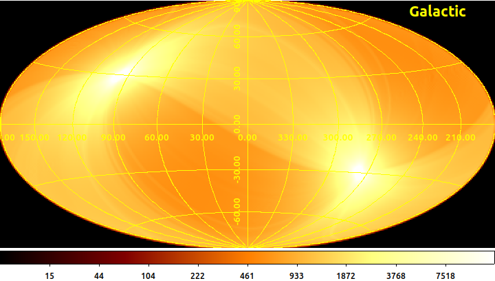
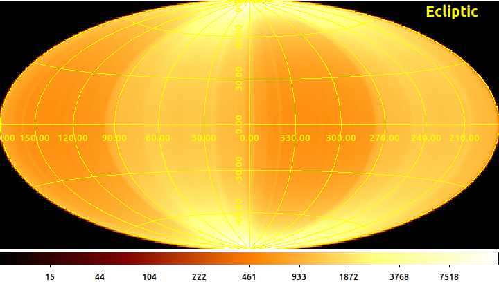
So far accumulated eRASS sky exposure incl. current plan; scheduled eROSITA exposure not corrected for observing efficiency, instrumental vignetting or fraction of active telescopes.
eRASS exposure map (Hammer-Aitoff projection) - FITS files: Ecliptic Equatorial Galactic
eRASS - the complete perspective
eRASS1-2-3-4-5
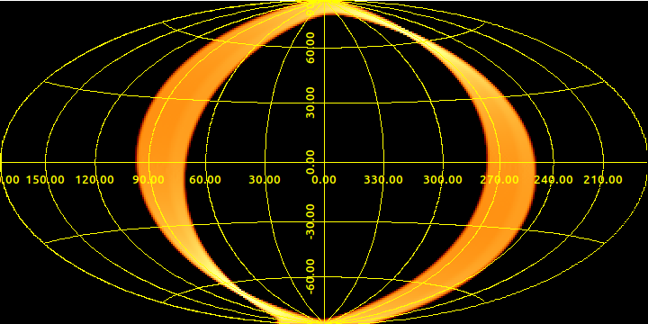
eRASS survey simulation using long-term SRG orbit calculation and ecl. pole as survey pole for eRASS5. Changes of trajectory or observing strategy might occur.
Scanned ecliptic longitudes per UTC date + MJD, period: 2021-12-19 – 2022-06-20.
FITS file: eRASS5 - scanned ecl. longitudes
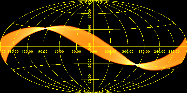
Exposure map from above simulation, 100% observing efficiency.
FITS file: single eRASS - exposure map
Sky-maps of scheduled eRASS1 exposure, scanned 8/11 December 2019 - 11 June 2020.


Sky-maps of scheduled eRASS2 exposure, scanned 11 June 2020 - 15 December 2020.
Sky-maps of scheduled eRASS3 exposure, scanned 15 December 2020 - 16 June 2021.

Sky-maps of scheduled eRASS4 exposure, scanned 16 June 2021 - 19 December 2021.
eROSITA sky tiles
The eRASS sky is divided into 4700 partly overlapping sky tiles of 3.6 x 3.6 deg each.
All-sky-survey processing tiles (FITS): equ. coords ; gal. coords
DS9 format region file: regions
(Sky tile files created by V. Doroshenko)